
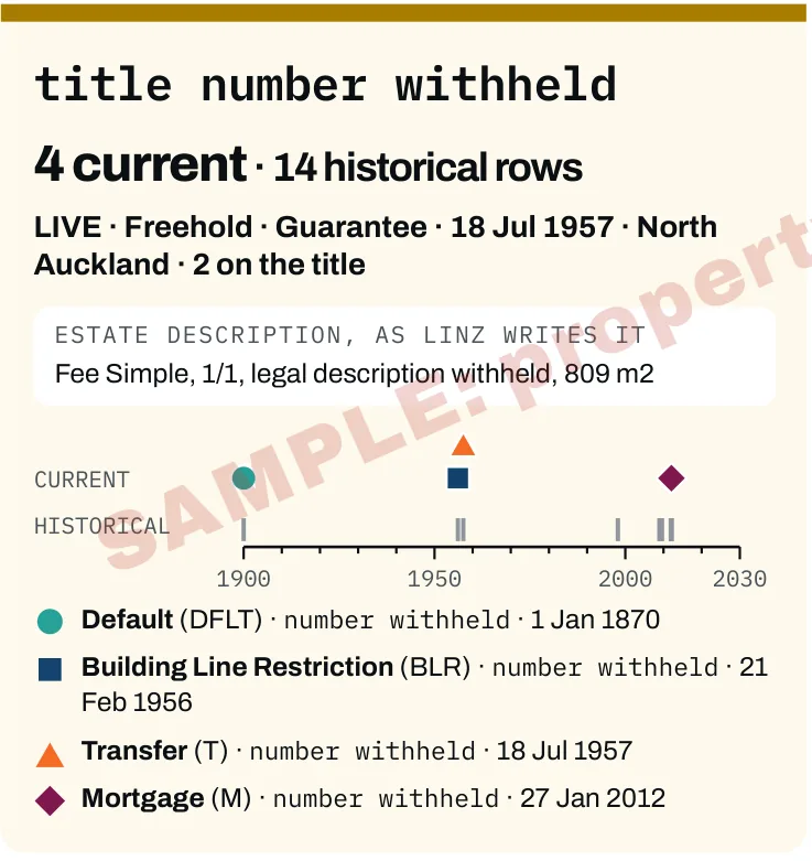
Each title, as LINZ records it
The titles on the parcel and the memorials LINZ lists against them, placed on a timeline by the date lodged. The report does not describe or interpret any instrument.
Property and Planning Records
Titles and memorials, the parcel and its neighbours, buildings on record, and the lines, plans and places mapped nearby. Every figure is printed with its source and record date.
$79incl. GST. $49 when bought with a Land Movement Report for the same property.
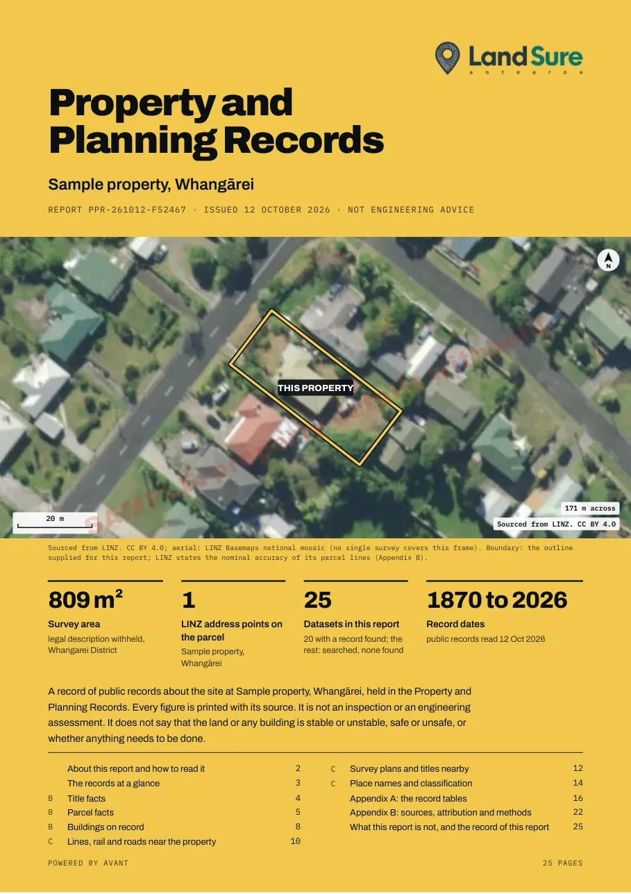
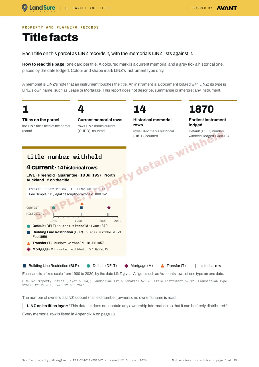
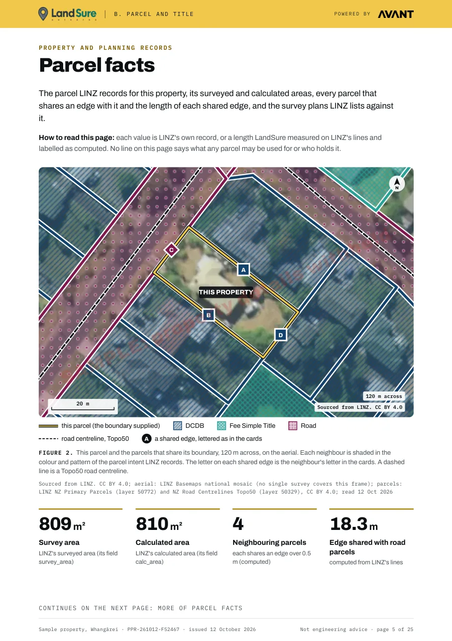
Each picture below is cut from the sample report for a sample property in Whangārei, with its address, legal description and title and instrument numbers withheld.
The titles on the parcel and the memorials LINZ lists against them, placed on a timeline by the date lodged. The report does not describe or interpret any instrument.
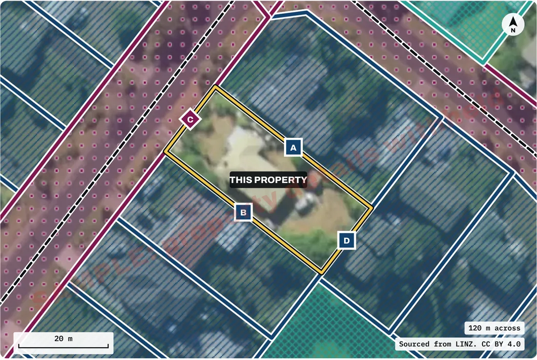
The parcel's surveyed and calculated areas, the parcels that share an edge with it, the length of each shared edge, and the survey plans LINZ lists against it.
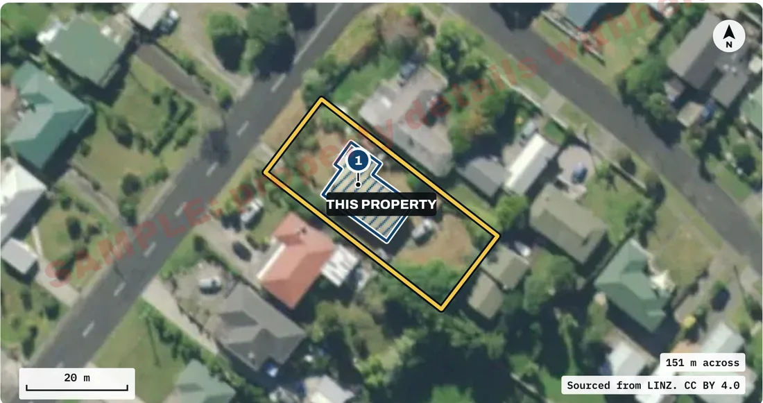
The building outlines LINZ has traced on the parcel from aerial photographs, with the photograph dates.
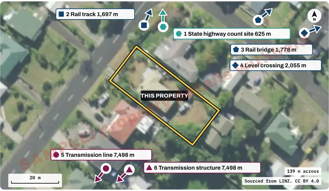
The nearest mapped rail, state highway count site and transmission records, each with its distance from the boundary, as each publisher maps them.
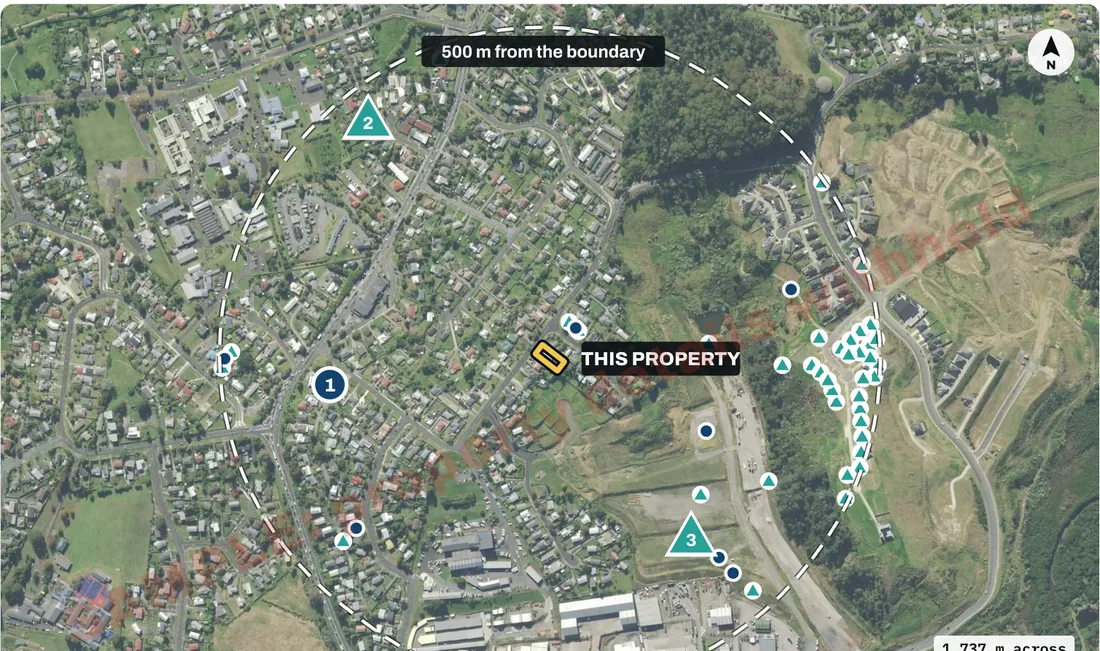
The survey plans and titles LINZ records within 500 m of the boundary.
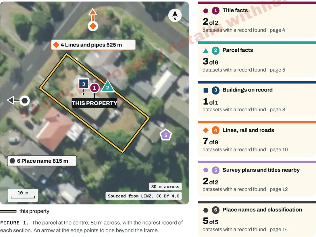
One page that lists each section, how many of its datasets found a record, and where the nearest record is.
See what the public record holds about a property, in one PDF, before you commit. It is not a LIM and does not replace one.
Keep a dated copy of what public datasets record about your property: its titles, its parcel and what is mapped around it.
Read the same public records a buyer or their adviser can look up, before the property goes on the market.
What is in the report
The sections below are from the sample report for a sample property in Whangārei, a public example with its address, legal description and title and instrument numbers withheld. This sample is in a district whose plan layer is not in the report, so it has no district plan page. The report covers only the datasets listed in its Appendix B. The number of pages depends on the records found for the property.
Pages from the sample Property and Planning Records report for a sample property in Whangārei, with its address, legal description and title and instrument numbers withheld (25 pages). Click a page to see it full size.
Cover - the parcel on LINZ aerial imagery, its survey area, the number of datasets and the contents.
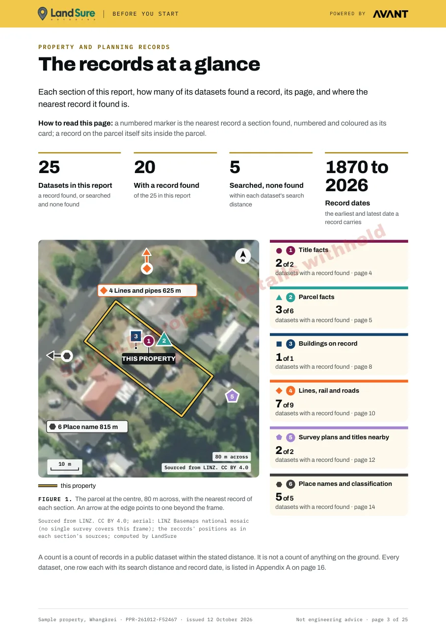
The records at a glance - each section, how many of its datasets found a record, and where the nearest record is.
Title facts - each title on the parcel as LINZ records it, with the memorials LINZ lists against it.
Parcel facts - the parcel, its areas, the parcels that share an edge with it and the survey plans LINZ lists.
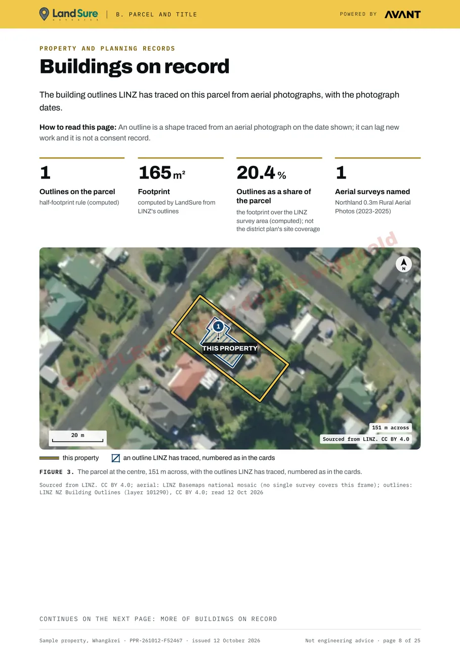
Buildings on record - the outlines LINZ has traced on the parcel, with the photograph dates.
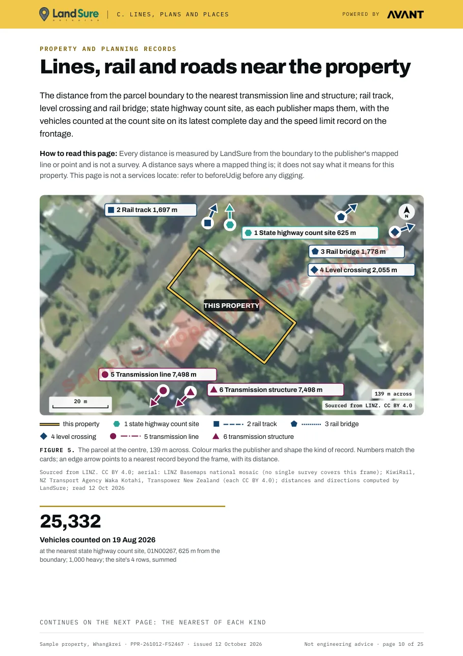
Lines, rail and roads near the property - the nearest mapped rail, highway count site and transmission records, with the distance to each.
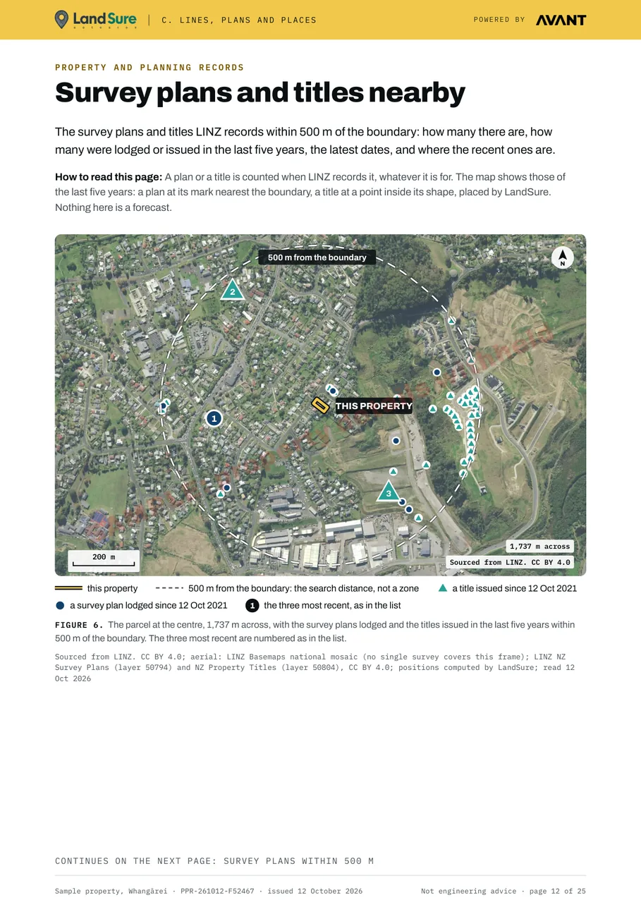
Survey plans and titles nearby - the plans and titles LINZ records within 500 m.
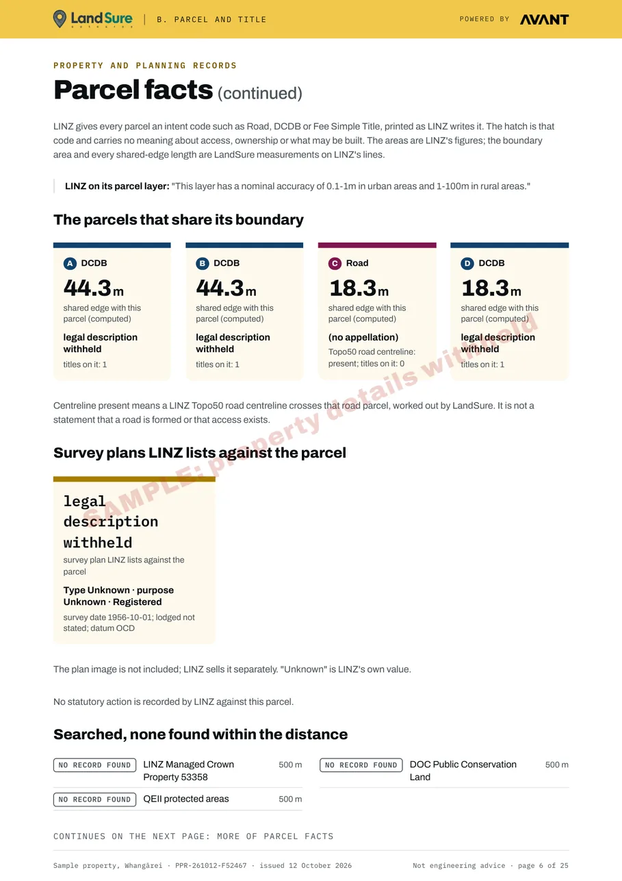
The parcels that share a boundary - each neighbouring parcel, the length of the edge it shares, and the survey plans LINZ lists against the parcel.
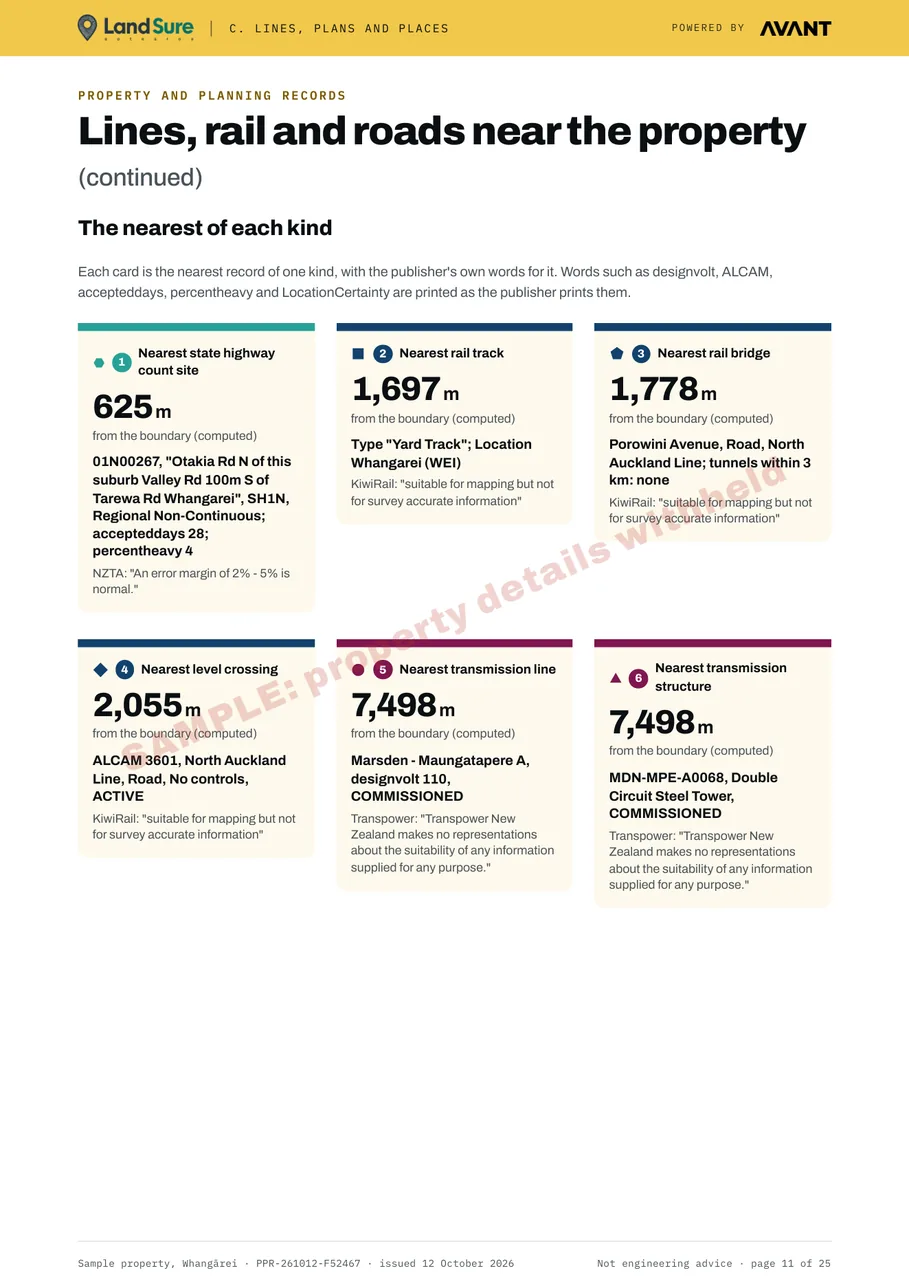
The nearest of each kind - the distance from the boundary to the nearest mapped rail, highway count site and transmission record of each kind.
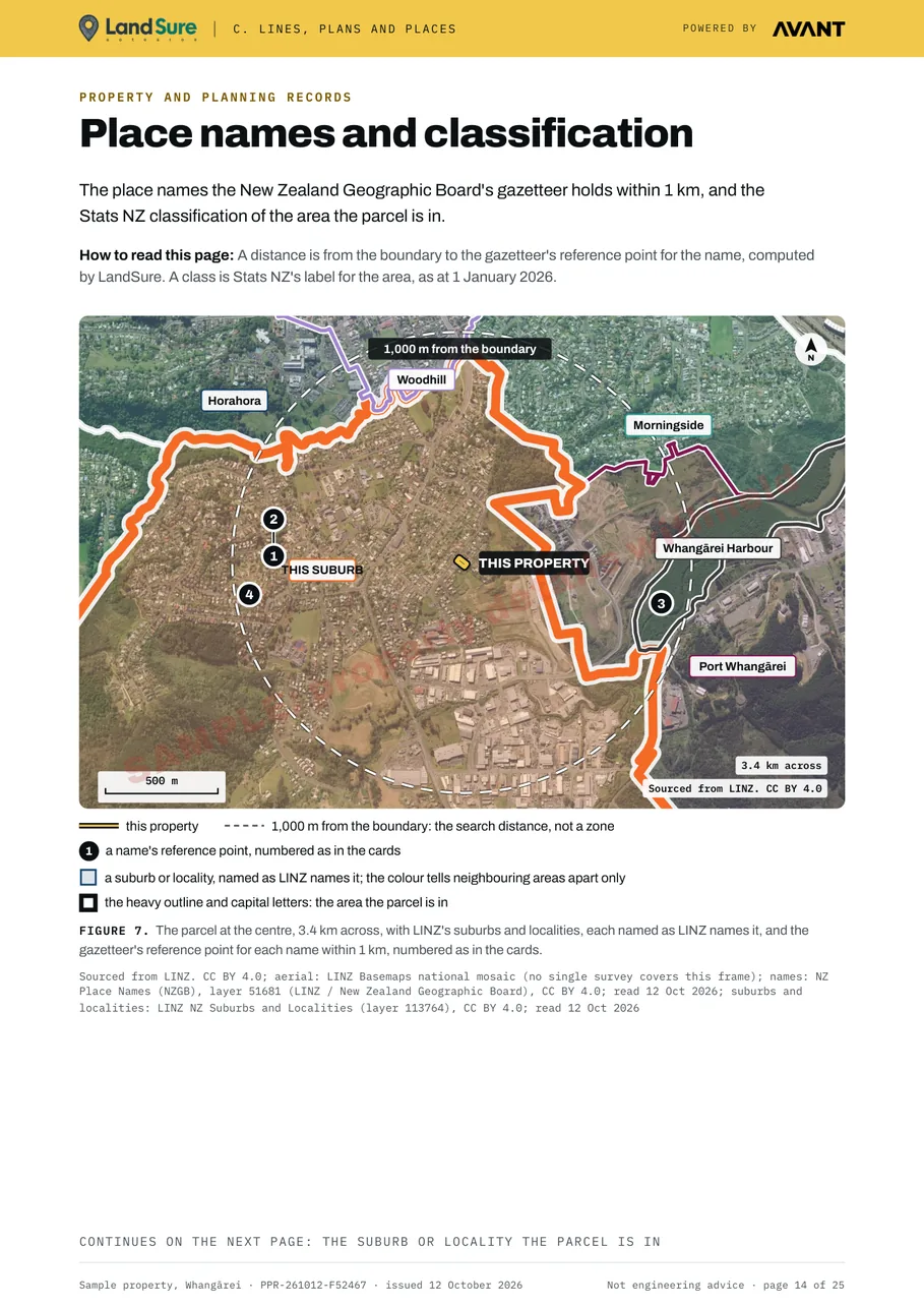
Place names and classification - the suburbs and localities around the parcel, the place names within 1 km, and Stats NZ's classification of the area.
Price
Prices are in New Zealand dollars and include GST.
| Bought | Price incl. GST |
|---|---|
| On its own | $79 |
| In the same payment as a Land Movement Report for the same property (the same LINZ title and parcels) | $49 |
The price is worked out again when you pay. The $49 price applies only when the Land Movement Report in the same payment is for the same LINZ title and parcels; otherwise the price is $79.
No discount codes. No owner copies.
How to order
The property finder looks up the property's LINZ title and parcels.
From the result, add Property and Planning Records on its own or with the Land Movement Report.
The report is emailed to you as a PDF within 24 hours of payment.
Please read before you buy. LandSure is not a geotechnical engineer, and this report is not a geotechnical assessment, certification or a professional opinion. It is a set of public records about the property, each with its source and record date. Not engineering advice. The report is issued to you and is for your use only: banks, insurers and councils cannot rely on it. No owner copies. The full terms are on the terms page.
The district plan zone and overlays are in the report only where it reads the council's open layer. At present that is Christchurch City Council's. For a property in any other district the report has no district plan page.
The report covers only the datasets listed in its Appendix B. It is not an inspection: nobody visits the property. It is not a survey, a valuation, a LIM, a hazard assessment or a forecast.
Each report is bought for one property. All are listed in the LandSure shop, with prices on the pricing page.
Up to ten years of satellite-measured ground movement at the property, in a plain-English PDF.
See the Land Movement Report →Report · from $199Public records about a rural block: land cover, ground and water, climate, and published farm and crop maps.
See Rural Land and Water Records →The property finder looks up the title and parcels. Add the report to your cart from the result.